Geography, History & Economy
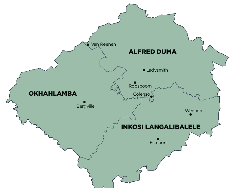
uThukela District Municipality comprises:
MDB code: DC23
Description: The uThukela District Municipality is a Category C municipality and is located on the western boundary of the KwaZulu-Natal Province. It is bordered by three other district municipalities: Amajuba, uMzinyathi and uMgungundlovu. It consists of three local municipalities: Okhahlamba, Alfred Duma and Inkosi Langalibalele.
The district derives its name from one of the major rivers in KwaZulu-Natal, the uThukela River, which rises from the Drakensberg Mountains and supplies water to a large portion of KZN, as well as Gauteng.
It is predominately rural and is characterised by poor socio-economic indicators such as low revenue base, poor infrastructure, limited access to services, and low economic base.
Area: 11 134km²
Cities/Towns: Bergville, Cathkin Park, Colenso, Estcourt, Ladysmith, Van Reenen, Weenen, Winterton
Main Economic Sectors: Manufacturing (21%), wholesale and retail trade, catering and accommodation (17%), finance, insurance, real estate and business services (15%)
