
Geography, History & Economy
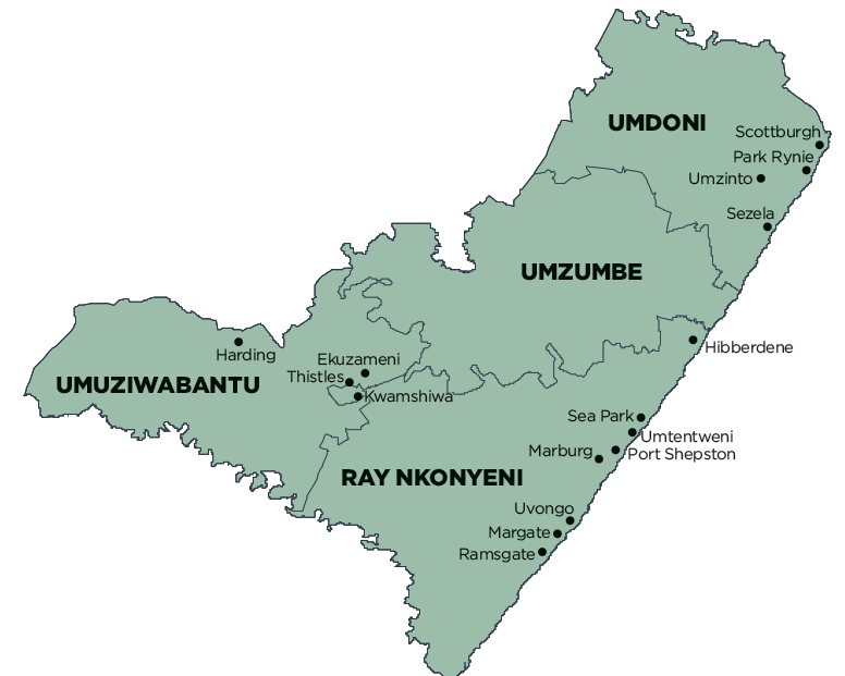
Ugu District Municipality comprises:
- Ray Nkonyeni Local Municipality
- Umdoni Local Municipality
- Umuziwabantu Local Municipality
- Umzumbe Local Municipality
MDB code: DC21
Description: The Ugu District Municipality is a Category C municipality situated in the far south of KwaZulu-Natal. It lies south of Durban, bordered by a coastline of 112km. The district is made up of four local municipalities: Umdoni, uMzumbe, Ray Nkonyeni and Umuziwabantu, all of which have played a critical role in the cultivation of the district’s economy.
The Ray Nkonyeni Municipality is the ultimate economy booster due to its location. Commercial agriculture in the district produces one-fifth of all bananas consumed in South Africa, with numerous companies successfully exporting these and other products to some of the most exclusive packers in the United Kingdom.
The Ugu District is the proud owner of Blue Flag Status beaches, which have marked tourism as a major economic cultivator. The improvement of its infrastructure, education, health and recreational facilities contributes immensely to its appeal. The nurturing of the local economy highly features tourism and agriculture, and includes the district’s very own Ugu Jazz Festival. It also includes other renowned annual activities, such as the Africa Bike Week, which have gained momentum worldwide.
Area: 4 791km²
Cities/Towns: Harding, Hibberdene, Margate, Pennington, Port Edward, Port Shepstone, Scottburgh/Umzinto North, Southbroom
Main Economic Sectors: Manufacturing (19%), finance, insurance, real estate and business services (17%), wholesale and retail trade, catering and accommodation (17%), transport, storage and communication (11%), agriculture, forestry and fishing (8%), community, social and personal services (7%), construction (4%)