
Geography, History & Economy
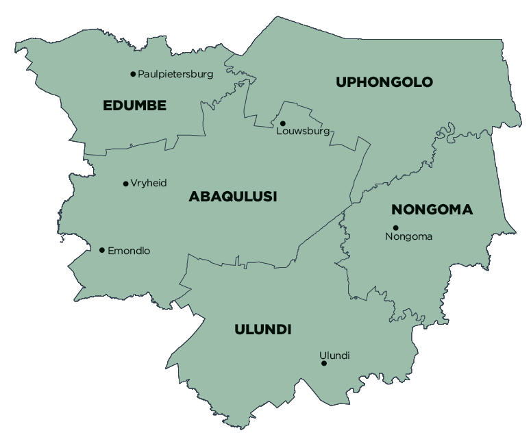
Zululand District Municipality comprises:
- AbaQulusi Local Municipality
- eDumbe Local Municipality
- Nongoma Local Municipality
- Ulundi Local Municipality
- uPhongolo Local Municipality
MDB code: DC26
Description: The Zululand District Municipality is a Category C municipality situated in the north-eastern part of KwaZulu-Natal. It is the biggest district in the province, making up 16% of its geographical area. It comprises five local municipalities: Ulundi, Nongoma, uPhongolo, eDumbe and AbaQulusi.
Vryheid and Ulundi are two urban centres of note in the district, respectively serving as a regional service and a regional and provincial administrative centre. The town of Vryheid is a commercial and business hub, while Ulundi Town is mainly an administrative centre and also the headquarters of the Zululand District Municipality.
It is primarily a rural district. About half the area falls under the jurisdiction of traditional authorities, while the remainder is privately owned commercial farms or protected areas.
Area: 14 799km²
Cities/Towns: Louwsburg, Nongoma, Paulpietersburg, Pongola, Ulundi, Vryheid
Main Economic Sectors: General government (22%), transport, storage and communication (16%), wholesale and retail trade, catering and accommodation (15%), finance, insurance, real estate and business services (11%), agriculture, forestry and fishing (10%), manufacturing (10%), community, social and business services (6%), mining and quarrying (5%), construction (3%), electricity, gas and water (2%)