Geography, History & Economy

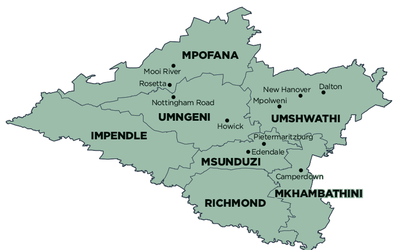
uMshwathi Local Municipality is part of uMgungundlovu District Municipality.
MDB code: KZN221
Description: The uMshwathi Local Municipality is a Category B municipality situated within the uMgungundlovu District, immediately adjacent to Pietermaritzburg, in the KwaZulu-Natal Province. It is the largest municipality of seven in the district.
The municipality is located in an area that was largely under the control of tribal authorities until very recently. However, in the remaining portion there are towns built by German immigrants some 150 years ago. In the 1850s, 13 cotton planter families from Osnabruck unter Bergthell left Germany and settled in the area. They were followed by missionaries and other colonists, mostly from Hanover, who also settled in the region, founded New Hanover and Wartburg, and brought with them not only the Lutheran faith but the German language and culture. Wartburg itself is named after the castle in Eisenach, where Dr Martin Luther translated the bible into German. The village crest also depicts the immigrants’ arrival by sailing ship, the Luther Rose, and the call to ‘pray and work’.
The land is mostly agricultural, although urban development is to be found in the main towns. The communities living in the underdeveloped areas have extremely limited access to basic physical and social requirements and very few economic opportunities. The present authority structures are, as yet, unable to provide for the improvement of basic living conditions urgently required by the rural inhabitants.
Area: 1 866km²
Cities/Towns: Cool Air, Dalton, New Hanover, Wartburg
Main Economic Sectors: Agriculture, manufacturing, tourism
