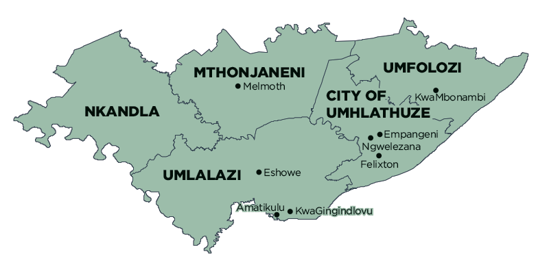
Part of Ntambanana Local Municipality was merged into Mthonjaneni Local Municipality on 3 August 2016. Financial, Employment and Service Delivery information prior to the 2016/17 financial year only includes figures for Mthonjaneni Local Municipality. View historical information for Ntambanana Local Municipality.
Geography, History & Economy
Mthonjaneni Local Municipality is part of King Cetshwayo District Municipality.
MDB code: KZN285
Description: The Mthonjaneni Local Municipality is a Category B municipality situated within the northern coastal region of KwaZulu-Natal, and is part of the King Cetshwayo District. It is approximately 170km north of Durban. It is one of five municipalities in the district.
The picturesque town of Melmoth was founded in 1888 as a ‘gold-rush’ town on a portion of the farm Golden Reef, when the British government annexed Zululand in 1887 and established several magisterial districts. It was decided to administer Mthonjaneni from a town named after the resident commissioner – Sir Melmoth Osborn. The former Melmoth Traditional Local Council area is the only town that was incorporated by the Mthonjaneni Municipality. In the past, the town performed the function of a dormitory town (and still does to some extent) for those who worked in the neighbouring town of Ulundi.
Mthonjaneni is one of the smallest municipalities in South Africa, but it has the distinction of being regarded as one of the healthiest places to live in this country. It is close to the Hluhluwe-Umfolozi and Opathe Game Reserves.
Area: 1 639km²
Cities/Towns: Melmoth, Ntambanana
Main Economic Sectors: Agriculture (33.5%), community services (20.9%), manufacturing (14%), finance (10.9%)
