
Geography, History & Economy
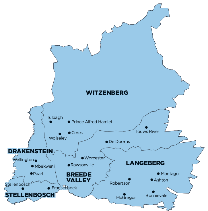
Witzenberg Local Municipality is part of Cape Winelands District Municipality.
MDB code: WC022
Description: The Witzenberg Local Municipality is a Category B municipality located within the Cape Winelands District in the Western Cape Province. The municipality is situated about 150km north-east of Cape Town.
The region is surrounded by three mountain ranges: the Obiqua Mountains to the west, the Winterhoek Mountains to the north and the Witzenberg Range to the east. It is the largest municipality of five in the district, making up half of its geographical area.
Rural areas within the municipal boundary are Warm Bokkeveld, Koue Bokkeveld, Agter-Witzenberg and the northern portion of Breede River Valley (Het Land van Waveren). The municipality is responsible for basic service provision to the demarcated municipal area that includes the towns of Ceres, Tulbagh, Prince Alfred Hamlet, Wolseley and Op-die-Berg.
Area: 10 753km²
Cities/Towns: Ceres, Op-Die-Berg, Prince Alfred Hamlet, Tulbagh, Wolseley
Main Economic Sectors: Agriculture, forestry and fishing (29.1%), finance, insurance, real estate and business services (22%), manufacturing (16.2%), wholesale and retail trade, catering and accommodation (10%), general government (8.4%), transport, storage and communication (8%), community, social and personal services (3.5%