
Geography, History & Economy
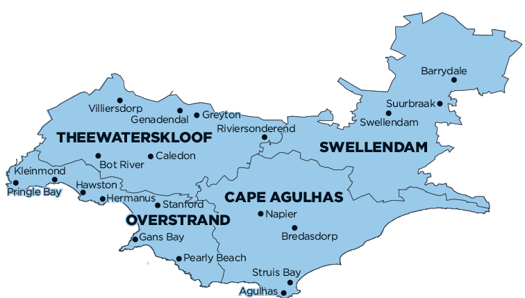
Overberg District Municipality comprises:
- Cape Agulhas Local Municipality
- Overstrand Local Municipality
- Swellendam Local Municipality
- Theewaterskloof Local Municipality
MDB code: DC3
Description: The Overberg District Municipality is a Category C municipality situated in the Western Cape Province, just over Sir Lowry’s Pass to the southernmost tip of Africa. The adjacent municipalities are the Cape Winelands District to the north, Garden Route District to the east and City of Cape Town to the west. It is also bounded by the Indian Ocean to the south-west and Atlantic Ocean to the west.
The municipality is the smallest district in the province, making up only 9% of its geographical area. The following local municipalities form part of the Overberg region: Theewaterskloof, Swellendam, Overstrand and Cape Agulhas. The seat of the municipality is Bredasdorp.
Area: 12 239km²
Cities/Towns: Agulhas, Arniston, Barrydale, Betty’s Bay, Birkenhead, Bot River, Bredasdorp, Buffeljagsrivier, Caledon/Myddleton, De Kelders, Elim, Fishershaven, Franskraal, Gans Bay, Genadendal, Grabouw, Greyton, Hawston, Hermanus, Infanta, Kleinmond, Klipdale, Malagas, Napier, Onrus, Pearly Beach, Pringle Bay, Protem, Riviersonderend, Rooi-Els, Sand Bay, Stanford, Struis Bay, Suiderstrand, Suurbraak, Swellendam, Theewaterskloof, Van Dyks Bay, Vermont, Villiersdorp
Main Economic Sectors: Finance, insurance, real estate and business services (25.1%), manufacturing (16.3%), wholesale and retail trade, catering and accommodation (13.7%), agriculture, forestry and fishing (12.1%), general government (10.5%), construction (8.5%), transport, storage and communication (8.3%), community, social and personal services (4.2%)