Geography, History & Economy
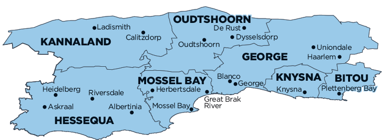
Hessequa Local Municipality is part of Garden Route District Municipality.
MDB code: WC042
Description: The Hessequa Local Municipality is a Category B municipality situated within the Garden Route District in the Western Cape Province. It lies at the foot of the Langeberg Mountains, with its boundaries stretching along the southern Cape coast from the Breede River in the west to Gouritsmond in the east. It is the largest of seven municipalities in the district, making up a quarter of its geographical area. The N2 National Road forms the main transportation conduit across the municipality.
Hessequa has a moderate climate. Rainfall occurs predominantly in winter and reaches totals of 300mm inland to 1 000mm on the coast. The Little Karoo in the rain shadow of the Langeberg is the driest region. Agricultural activities are largely determined by the local rainfall pattern. Most of the basal geology in Hessequa has been influenced by the Cape Fold Belt, which has caused the east-west heading mountains generally comprising hard quartzite sandstone and thin shale bands of the Table Mountain Group.
Hessequa’s vegetation falls within the Cape Floral Kingdom, which is characterised by its exceptional richness in plant species. More than 8 700 species are known to occur, of which two thirds are endemic. About 75% of all plants in the South African Red Data Book are found in the Cape Floral Kingdom. Of these species, about 1 700 are threatened with extinction. The major biomes occurring within Hessequa may be divided into nine major vegetation groups.
Area: 5 733km²
Cities/Towns: Albertinia, Gouritz, Heidelberg, Jongensfontein, Riversdale, Slangrivier, Still Bay, Witsand
Main Economic Sectors: Trade (20.3%), community services (18.5%), construction (15.6%), finance (15%), agriculture (14.3%), transport (12.2%), manufacturing (3%)
