Geography, History & Economy
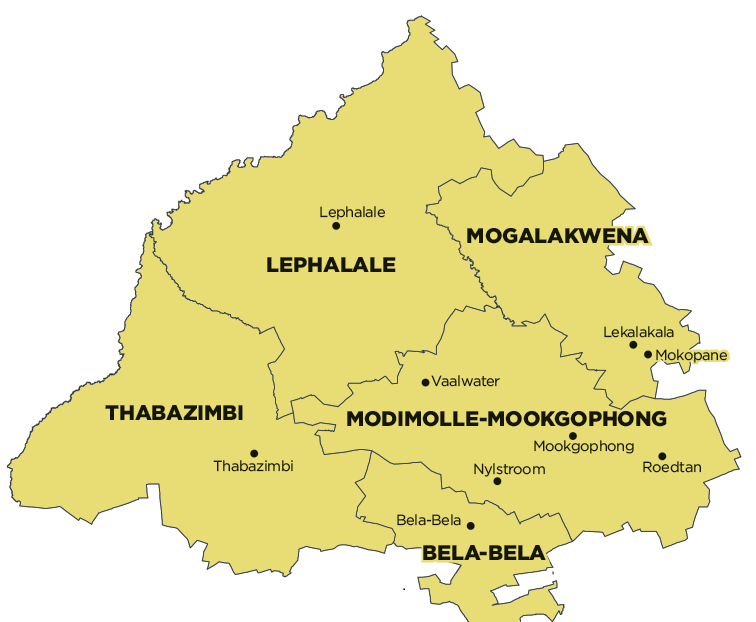
Waterberg District Municipality comprises:
Bela-Bela Local Municipality
Lephalale Local Municipality
Modimolle-Mookgophong Local Municipality
Mogalakwena Local Municipality
Thabazimbi Local Municipality
MDB code: DC36
Description: The Waterberg District Municipality is a Category C municipality located in the western part of the Limpopo Province. It is strategically located in sharing its borders with Capricorn District Municipality in the north and Sekhukhune District Municipality in the east. The south-western boundary abuts the North West, while the Gauteng Province lies on the south-eastern side.
The municipality is the biggest district in the province, making up just more than a third of its geographical area. It shares its five-border control points with Botswana, namely Groblersbrug, Stockpoort, Derdepoort, Zanzibar and Platjan. It is comprised of five local municipalities: Bela-Bela, Lephalale, Modimolle-Mookgophong, Mogalakwena and Thabazimbi.
The region, as we know it today, is more than three million years old. With its great variety of wildlife, birds and scenic splendour. It is one of South Africa’s prime ecotourism destinations.
Area: 44 913km²
Cities/Towns: Amandelbult Mine Town, Bela-Bela, Lephalale, Modimolle, Mokopane (Potgietersrus), Mookgophong (Naboomspruit), Pienaarsrivier, Thabazimbi, Vaalwater
Main Economic Sectors: Mining, agriculture, tourism
