
Welcome to Provincial Executive Committee of Muslim Supreme Council of South Africa ( MUSCOOSA) for Limpopo province comprised of Provincial Mufti, Regional Representatives who are leaders of Municipalities and Districts that makes up Limpopo Province Called Municipal Qadhi or District Qadhi, and Town representatives.
Each town of a Municipality or District has a leader in Charge of Islam and Muslim affairs who is responsible for Council of Imams and Muadhins of that Municipality or District called Town Representatives who reports to Regional representatives called Municipal Qadhi and District Qadhi, who reports to Provincial Mufti.
The office of Provincial Mufti monitors operations of Regional Representatives called Municiplal Qadhi, District Qadhi and Town Representatives with following Structure:
- Regional Representatives are Heads of Islam Affairs in Municipalities and districts called Municipal Qadhi and Disrict Qadhi. There are representatives in every town that makes a Municipality or District those who report to Municipal Qadhi or District Qadhi.
- Municipal Qadhis and District Qadhis are Deputies of Provincial Muftis, they make part of Provincial Executive Committee headed by Mufti of the Province.
- Provincial Muftis, Municipal Qadhi and District Qadhi all form part of Council of Sheikhs ( Majlisil Ulama).
Municipal Qadhi and District Qadhi coordinate with Mayors office , all town representatives reports back to him. the management has a team of members comprised of:
- Provincial Mufti
- Regional Representatives called Municipal Qadhi and And District Qadhi
- Secretary
- Head of Imams and Muadhins in Municipality and District
- Town Representatives in charge of Council of Imams and Muadhins .
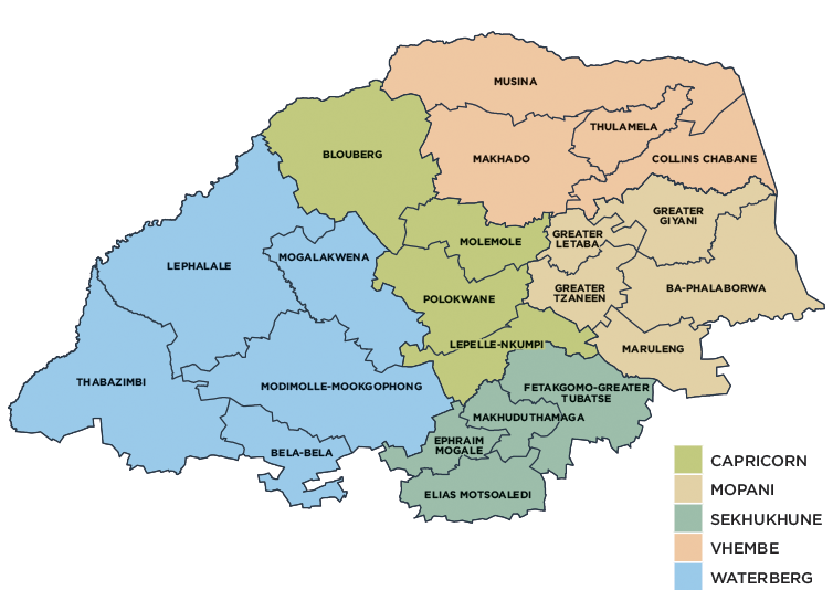
Map Showing Municipalities and Districts of Limpopo province
Overview
Limpopo, South Africa’s northernmost province, borders onto Mozambique, Zimbabwe and Botswana. It also borders the Mpumalanga, Gauteng and North West provinces. Named after the Limpopo River, which flows along its northern border, it is a region of contrasts, from true Bushveld country to majestic mountains, primeval indigenous forests, unspoiled wilderness and patchworks of farmland. In the eastern region lies the northern half of the magnificent Kruger National Park.
Limpopo ranks fifth in South Africa in both surface area and population, covering an area of 125 754km² and being home to a population of 5 779 090. The capital is Polokwane (previously Pietersburg). Other major cities and towns include Bela-Bela (Warmbad), Lephalale (Ellisras), Makhado (Louis Trichardt), Musina (Messina), Thabazimbi and Tzaneen.
Mining is the primary driver of economic activity. Limpopo is rich in mineral deposits, including platinum-group metals, iron ore, chromium, high and middle-grade coking coal, diamonds, antimony, phosphate and copper, as well as mineral reserves such as gold, emeralds, scheelite, magnetite, vermiculite, silicon and mica. The province is a typical developing area, exporting primary products and importing manufactured goods and services.
The climatic conditions in the province allow for double harvesting seasons, which results in it being the largest producer of various crops in the agricultural market. Sunflowers, cotton, maize and peanuts are cultivated in the Bela-Bela–Modimolle area. Bananas, litchis, pineapples, mangoes and pawpaws, as well as a variety of nuts, are grown in the Tzaneen and Makhado areas. Extensive tea and coffee plantations create many employment opportunities in the Tzaneen area. The Bushveld is cattle country, where controlled hunting is often combined with ranching.
Limpopo is divided into five district municipalities, which are further subdivided into 22 local municipalities