
Geography, History & Economy
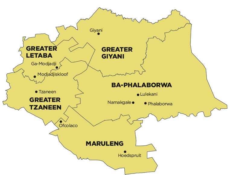
Greater Tzaneen Local Municipality is part of Mopani District Municipality.
MDB code: LIM333
Description: The Greater Tzaneen Local Municipality is a Category B municipality situated in the eastern quadrant of the Limpopo Province within the Mopani District. It is bordered by Greater Letaba to the north, Lepelle-Nkumpi to the south, Ba-Phalaborwa and Maruleng to the east, and Polokwane to the west. It is one of the five municipalities in the district. It contains 125 rural villages, with almost 80% of households residing in these villages.
The Phalaborwa SDI transverses the area, while one of the major road links between Gauteng and the Kruger National Park also passes through the area. It is characterised by extensive and intensive farming activities and considerable untapped tourism potential.
Area: 2 897km²
Cities/Towns: Haenertsburg, Tzaneen
Main Economic Sectors: Community services (31.7%), finance (23.8%), trade (10.2%), agriculture (7.6%), manufacturing (3.7%)