
Geography, History & Economy
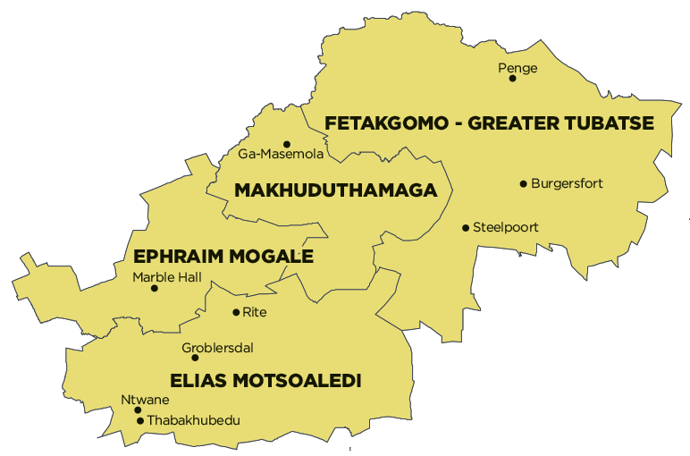
Sekhukhune District Municipality comprises:
Elias Motsoaledi Local Municipality
Ephraim Mogale Local Municipality
Fetakgomo Tubatse Local Municipality
Makhuduthamaga Local Municipality
MDB code: DC47
Description: The Sekhukhune District Municipality is a Category C municipality and is located in the Limpopo Province, the northernmost part of South Africa. It lies in the south-eastern part of the province, bordering on the Capricorn and Mopani Districts in the north, Mpumalanga in the south and east, and the Waterberg District in the west.
The district is the smallest in the province, making up 11% of its geographical area. It is comprised of four local municipalities: Elias Motsoaledi, Ephraim Mogale, Makhuduthamaga and Fetakgomo Tubatse. The area’s towns and villages are serviced by its major river – the Olifants.
Area: 13 528km²
Cities/Towns: Burgersfort, Groblersdal, Marble Hall, Ohrigstad, Roossenekal, Schuinsdraai Nature Reserve, Steelpoort
Main Economic Sectors: Community services, mining (15-20%), trade (17%), financial and business services (10-12%), agriculture (9.7%)