
Geography, History & Economy
Makhuduthamaga Local Municipality is part of Sekhukhune District Municipality.
MDB code: LIM473
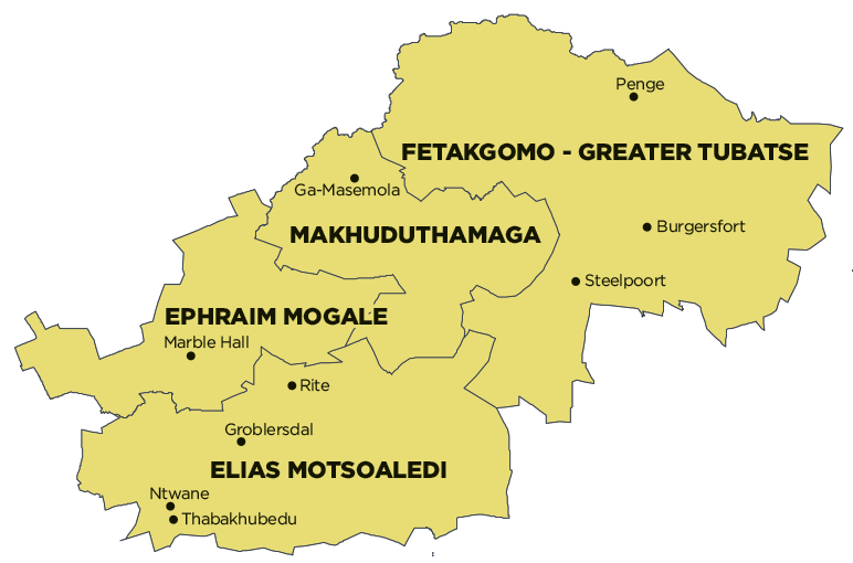
Description: The Makhuduthamaga Local Municipality is a Category B municipality situated within the Sekhukhune District Municipality in the Limpopo Province. It is bordered by the Capricorn District in the north, Elias Motsoaledi in the south, Fetakgomo Tubatse Local Municipality in the east, and Ephraim Mogale in the west. It is one of the four municipalities that make up the district, accounting for 16% of its geographical area.
The name is derived from the liberation name given to those who supported the anti-apartheid struggle in Sekhukhuneland in the 1950s. Makhuduthamaga raged a war against the white commissioner and his assailants, Marentsara.
Area: 2 110km²
Main Economic Sectors: Agriculture, farming