
Geography, History & Economy
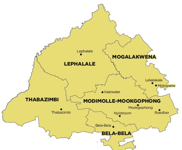
Bela-Bela Local Municipality is part of Waterberg District Municipality.
MDB code: LIM366
Description: The Bela-Bela Local Municipality is a Category B municipality situated within the Waterberg District in the Limpopo Province. The municipality shares borders with the Gauteng, Mpumalanga and North West Provinces. It also shares municipal borders with Modimolle-Mookgophong to the north and Thabazimbi to the west.
Bela-Bela Central Business District (CBD) is directly linked with the major cities of Gauteng through the N1 National Route, which connects the area with Pretoria at the approximate distance of 100km, and with Johannesburg, which is approximately 170km from Bela-Bela CBD, as well as Polokwane (previously Pietersburg), which is approximately 200km away.
The town, Bela-Bela (previously Warmbad), continues to be the central growth point of the municipal area, with potential for further economic growth and development. The tourism industry is the main driver of the local economy and by far the largest contributor to the district’s GDP.
Area: 3 406km²
Cities/Towns: Bela-Bela, Pienaarsrivier
Main Economic Sectors: Tourism, agriculture