
Geography, History & Economy
Nala Local Municipality is part of Lejweleputswa District Municipality.
MDB code: FS185
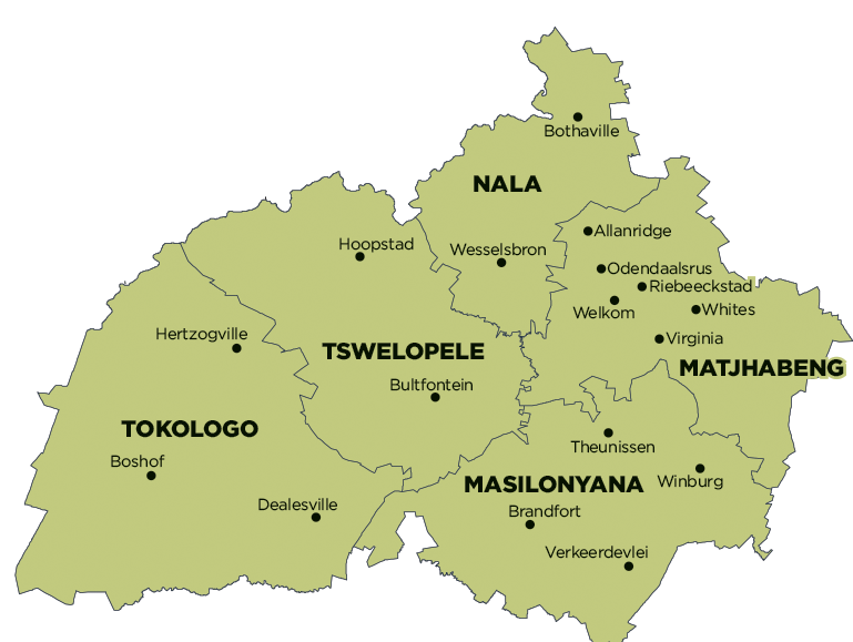
Description: The Nala Local Municipality is a Category B municipality situated in the northern part of the Lejweleputswa District in the Free State. The former Bothaville and Wesselsbron Traditional Local Councils and a section of the Vetvaal Transitional Rural Council were combined to form the Nala Local Municipality.
The Bothaville/Kgotsong area is located approximately 50km south of Klerksdorp, 80km north of Welkom and 200km south of Gauteng. Wesselsbron/Monyakeng is situated approximately 70km south-west of Bothaville, approximately 35km west of Welkom/Odendaalsrus and 55km east of Hoopstad.
The Nala region is located within a significant agricultural region. It forms part of the so-called ‘Maize Triangle’ of South Africa. Bothaville is strategically located close to the gold mining towns of Klerksdorp/Orkney, whilst Wesselsbron is in close proximity of Welkom/Odendaalsrus. They are directly dependent on these large urban centres for institutional and commercial support.
Three major rivers feature prominently in the Free State Province, of which two flow through the Nala Municipality. The Vals River runs from east to west through the town of Bothaville towards the Vaal River, which forms the north-western boundary of the municipality, and the Vet River flows just south of the Wesselsbron district and forms the southern boundary of the Nala region. Both the rivers play a significant role in the provision of water to Bothaville and Wesselsbron respectively. The topography of the area is homogenous, with moderate slopes. The only significant natural feature is the sensitive wetland system found just south of Wesselsbron.
Area: 4 129km²
Cities/Towns: Bothaville, Wesselsbron
Main Economic Sectors: Agriculture