
Geography, History & Economy
Mohokare Local Municipality is part of Xhariep District Municipality.
MDB code: FS163
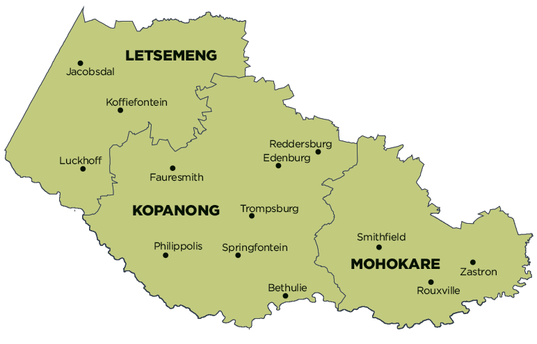
Description: The Mohokare Local Municipality is a Category B municipality situated within the Xhariep District in the south-eastern Free State. It is the smallest of three municipalities in the district, making up a quarter of its geographical area.
Zastron is perhaps the best-known of the three villages in this area. At the foot of the Aasvöelberg is the famous Eye of Zastron, a 9m-wide hole through a sandstone rock. Examples of Bushman art can be found on the various farms in the area. Zastron is very close to Lesotho and a great place to start exploring.
Smithfield has a peaceful, splendidly vast, unpolluted countryside, tucked neatly into a horseshoe of hills. Established in 1848 and named after Sir Harry Smith, then Governor of the Cape, Smithfield is the third-oldest town in the Free State province.
Rouxville is in the middle of a number of other interesting places such as Smithfield, Aliwal, Xhariep and Zastron, and boasts the impressive Maloti Mountains as a backdrop. Situated on the N6, Rouxville was founded by Petrus Wepenaar in 1863 on the farm Zuurbult. It was named after Reverand Pieter Roux, who travelled throughout the eastern Free State for many years holding church services for local communities. During the Anglo-Boer War, all of its citizens were called up and the town was completely deserted for two years.
Area: 8 776km²
Cities/Towns: Rouxville, Smithfield, Zastron
Main Economic Sectors: Agriculture, tourism