Geography, History & Economy
Moqhaka Local Municipality is part of Fezile Dabi District Municipality.
MDB code: FS201
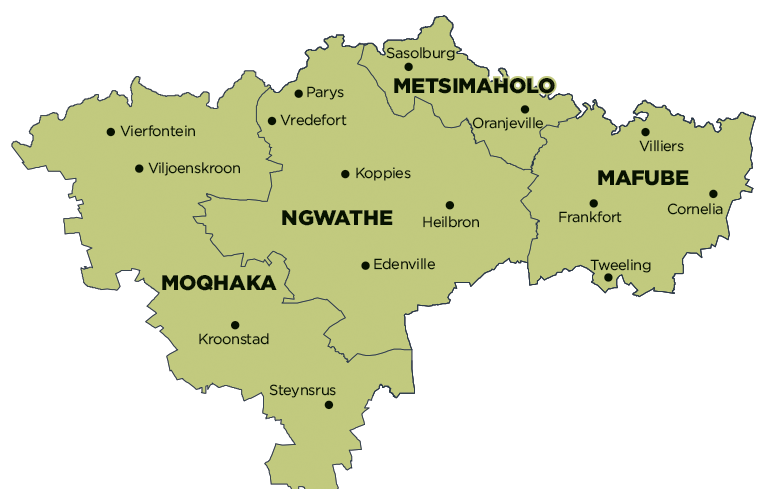
Description: The Moqhaka Local Municipality is a Category B municipality situated within the southern part of the Fezile Dabi District in the Free State Province. It is the largest of four municipalities in the district, making up over a third of its geographical area. The former Kroonstad, Steynsrus and Viljoenskroon Transitional Local Councils and sections of the Riemland, Kroonkop and Koepel Transitional Rural Councils are included in the municipality. The seat of local government is Kroonstad. The community name is the south Sesotho word for ‘crown’.
The general tendency of migration from rural to urban areas is also occurring in the area, as is the case in the rest of the Free State Province. In comparison to the other municipalities within the Fezile Dabi District, it appears as if Moqhaka is significantly less urbanised.
The Greater Kroonstad area is the centre of a large agricultural community that plays an important role in the economy of the district. Subsequently, industrial activities contribute significantly to the district’s economy. The Department of Correctional Services and the School of Engineers military bases are situated in the town. Kroonstad has recently become a distinguished holiday destination due to the ultra-modern and popular holiday resort of Kroonpark, adjacent to the Vals River. The urban area is situated adjacent to the N1 National Road, and located adjacent to one of the largest and most important four-way railway junctions in South Africa.
The Viljoenskroon/Rammulotsi urban area is located within an area of extreme agricultural significance. The urban area plays a significant role in providing residential opportunities to the adjacent goldfields and mining activities in the North West province. The Provincial Roads P15/1 and P15/2 from Kroonstad to Klerksdorp in the North West province extend through the area from north to south.
The Steynsrus/Matlwangtlwang urban area is situated approximately 45km east of Kroonstad and 92km west of Bethlehem. The major link road between Bethlehem and Kroonstad stretches adjacent to the urban area.
Area: 7 925km²
Cities/Towns: Kroonstad, Renovaal, Steynsrus, Vierfontein, Viljoenskroon
Main Economic Sectors: Agiculture, commercial transport, business services, mining
