Geography, History & Economy
Mafube Local Municipality is part of Fezile Dabi District Municipality.
MDB code: FS205
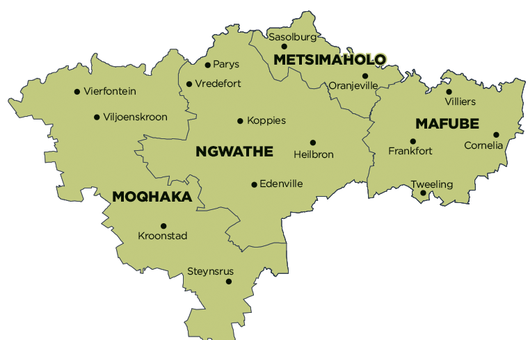
Description: The Mafube Local Municipality is a Category B municipality in the Fezile Dabi District of the Free State Province. It is one of the four municipalities in the district, making up almost a quarter of its geographical area. The name is a Sesotho word meaning ‘dawning of the new day’.
Frankfort remains the growth point in Mafube, and plays a major role in terms of regional service provision and industrial and commercial development. Frankfort is situated 55km east of Heilbron and approximately 120km south-east of Sasolburg. Frankfort is a typically-developed small town, serving the predominant surrounding agricultural community.
The Greater Tweeling area is located approximately 150km east of Sasolburg and 350km north-east of Bloemfontein, and is situated adjacent to the Frankfort/Reitz Primary Road. Other larger centres, such as Vereeniging and Vanderbijlpark, are all within 160km of Tweeling. Primary agricultural activities include sheep and cattle farming, maize, and sunflower seed production.
The Villiers Town area is situated on the banks of the Vaal River, adjacent to the N3 National Road between Gauteng and Durban. In relation to other major centres, the town is located 120km from Johannesburg, 80km from Vereeniging and 117km from Sasolburg. Villiers is predominantly agriculture-orientated, where products such as maize, sunflower, wheat, grain, sorghum, meat and dairy are produced. Villiers functions as the main concentration point for products in the district, from where they are directly exported. The grain silos in Villiers, together with other grain silos in the district, have a storage capacity of 273 000 tons.
The Greater Cornelia area is situated 40km east of Frankfort, 160km east of Sasolburg and 32km south-east of Villiers. The town is situated adjacent to the R103 Secondary Road between Warden and Villiers. Cornelia typically developed as a small town serving the predominant surrounding agricultural community.
Area: 3 971km²
Cities/Towns: Cornelia, Frankfort, Tweeling, Villiers
Main Economic Sectors: Community services (28.1%), manufacturing (24%), agriculture (13.9%), finance (12.1%), trade (9%), transport (7%), construction (4.5%)
