Geography, History & Economy

Midvaal Local Municipality is part of Sedibeng District Municipality
MDB code: GT422
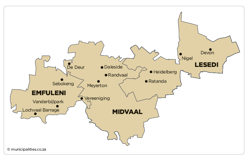
Description: The Midvaal Local Municipality is a Category B municipality situated within the Sedibeng District in the south of the Gauteng Province. The City of Ekurhuleni and City of Johannesburg Metropolitan Municipalities are situated to the north. It is bordered by the Free State Province to the south and the Mpumalanga Province to the east. It is the biggest municipality of three in the district, making up almost half of its geographical area.
The spatial structure of the Midvaal municipal area is predominantly that of a rural area, with extensive farming. There are two significant natural features impacting on the physical structure, namely the Suikerbosrand Nature Reserve and the Vaal River, which form the southern boundary of the municipality and the Gauteng Province. Secondary natural features that play a significant role in the development dynamics of the area are the Klip River, Suikerbosrand River and the Vaal Dam.
Area: 1 722km²
Cities/Towns: De Deur/Walkerville, Eikenhof, Meyerton, Vaal Marina
Main Economic Sectors: Manufacturing (25.1%), community services (22.5%), finance (20.4%), trade (11.4%), transport (6.1%), electricity (5.7%), construction (5.7%), agriculture (2.6%)
