
Geography, History & Economy
Mogale City Local Municipality is part of West Rand District Municipality
MDB code: GT481
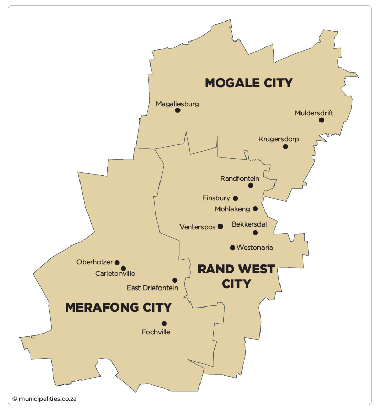
Description: The Mogale City Local Municipality is a Category B municipality located within the West Rand District in the Gauteng Province. It lies directly south and west of the City of Tshwane and City of Johannesburg Metropolitan areas respectively. To the north, south and west it borders onto the Madibeng, Rand West City and Rustenburg Local Municipalities respectively.
The northern part of Mogale City comprises the bulk of the Cradle of Humankind World Heritage Site. Mogale City’s strongest functional urban linkage is with the City of Johannesburg. Krugersdorp and the greater Kagiso area, Mogale City’s primary urban complex, forms part of a band of development stretching from the Johannesburg Inner City westwards along the mining belt up to Krugersdorp. The strongest east-west transport linkages between Mogale City and Johannesburg are along the R512, as well as the east-west railway line. Mogale City is linked to the City of Tshwane via the R28/N14 highway.
The largest part of Mogale City is rural, with a specific urban concentration in the south-eastern part of the municipality where it interfaces with the Gauteng urban complex. The rural environment is characterised by prominent features: the Magaliesburg and Witwatersberg Ranges in the north-west. Rural towns in Mogale City are Tarlton, Magaliesburg and Hekpoort, located in the west.
An urban concentration is found in the south-eastern part around Krugersdorp and Kagiso. The Krugersdorp CBD is the main business, social and administration centre and fulfils a regional function. The areas around Krugersdorp are established middle-to-high income residential areas with the full range of urban amenities, services and facilities.
The areas to the south of Krugersdorp, namely Kagiso, Azaadville and Rietvallel (referred to as the Kagiso complex), are predominantly disadvantaged settlements with more limited access to service and facilities. The Kagiso complex is physically separated from Krugersdorp’s urban areas by an extensive mining belt that runs roughly in an east-west direction through the area.
Area: 1 342km²
Cities/Towns: Krugersdorp, Magaliesburg, Muldersdrift
Main Economic Sectors: Mining services, transport, energy, manufacturing, tourism, agriculture