
Geography, History & Economy
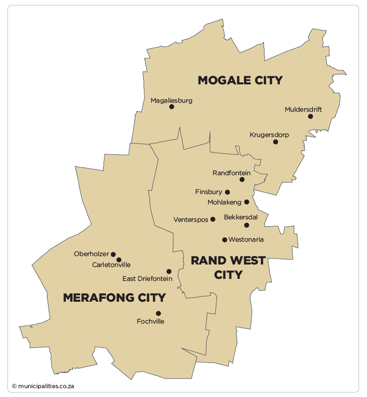
West Rand District Municipality comprises:
- Merafong City Local
- Mogale City Local
- Rand West City Local
MDB code: DC48
Description: The West Rand District Municipality is a Category C municipality located in the west of the Gauteng Province. The West Rand extends from Randfontein (the seat of the district) in the west to Roodepoort in the east, and includes the town of Krugersdorp. It is bordered by Bojanala Platinum to the north-west, City of Tshwane to the north-east, City of Johannesburg to the east, Sedibeng to the south-east, and Dr Kenneth Kaunda to the south-west. It comprises three local municipalities: Merafong, Mogale and Rand West Cities.
The municipality is situated relatively closely to the hub of economic activity in Gauteng, and is transversed by major national roads, namely the N12 and N14. Its main contribution lies primarily within the mining sector, however, areas such as Krugersdorp fulfil a residential function for many people working in Johannesburg. The West Rand remains the poorest region contributing to Gauteng’s GDP.
The Cradle of Humankind falls under the jurisdiction of Mogale City and Merafong City, and forms part of the World Heritage Site.
Area: 4 087km²
Cities/Towns: Carletonville, Fochville, Krugersdorp, Magaliesburg, Muldersdrift, Randfontein, Wedela, Westonaria
Main Economic Sectors: Manufacturing (22%), mining (19%), community services (19%), finance (16%), trade (10%), transport (6%), construction (4%)