Geography, History & Economy
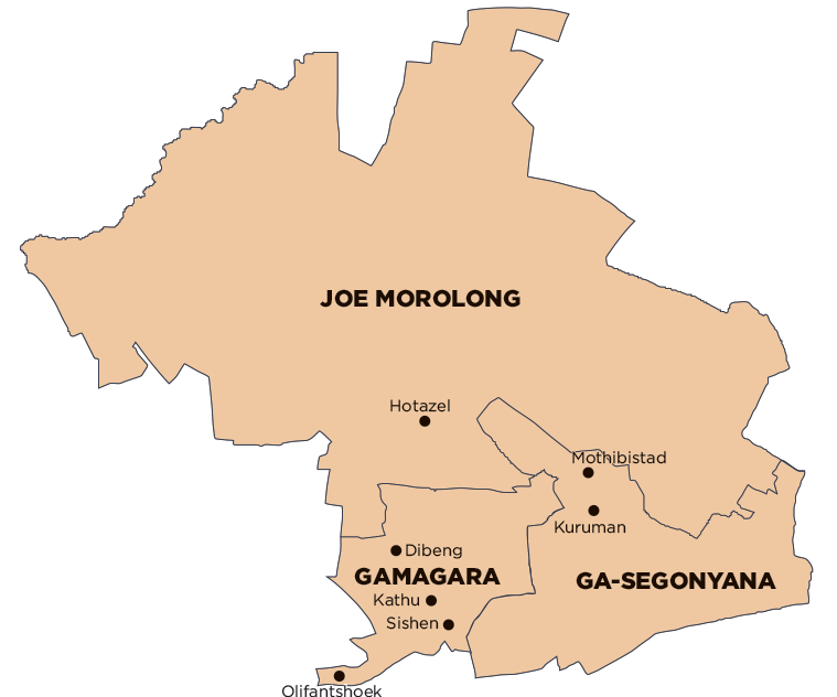
John Taolo Gaetsewe District Municipality comprises:
Ga-Segonyana Local Municipality
Gamagara Local Municipality
Joe Morolong Local Municipality
MDB code: DC45
Description: The John Taolo Gaetsewe District Municipality (previously Kgalagadi) is a Category C municipality located in the north of the Northern Cape Province, bordering Botswana in the west. It comprises the three local municipalities of Gamagara, Ga-Segonyana and Joe Morolong, and 186 towns and settlements, of which the majority (80%) are villages.
The boundaries of this district were demarcated in 2006 to include the once north-western part of Joe Morolong and Olifantshoek, along with its surrounds, into the Gamagara Local Municipality.
It has an established rail network from Sishen South and between Black Rock and Dibeng. It is characterised by a mixture of land uses, of which agriculture and mining are dominant. The district holds potential as a viable tourist destination and has numerous growth opportunities in the industrial sector.
Area: 27 322km²
Cities/Towns: Bankhara-Bodulong, Deben, Hotazel, Kathu, Kuruman, Mothibistad, Olifantshoek, Santoy, Van Zylsrus
Main Economic Sectors: Agriculture, mining, retail
