
Geography, History & Economy
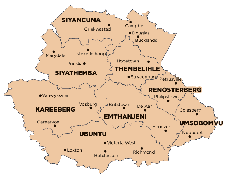
Renosterberg Local Municipality is part of Pixley Ka Seme District Municipality.
MDB code: NC075
Description: The Renosterberg Local Municipality is a Category B municipality located in the Pixley Ka Seme District of the Northern Cape, known as the Karoo region. It is the smallest of eight municipalities in the district, making up only 5% of its geographical area.
Petrusville is a typical upper Karoo semi-desert suburb with flat hilltops. The region is also rich with history and culture. The Dutch Reformed Church Museum exhibits century-old clothing and a horse-drawn hooded cart. The Pillar Fountain was erected to honour King Edward VII. Most of the original town dwellings are simple structures with a prominent, covered veranda as protection against the sun. The more elaborate homes have traces of Victorian style, but still maintain a Karoo-like integrity.
In the Karoo Battlefields, the bitter conflict brought about by the Anglo-Boer War (1899-1902) has left its mark in world history. The best-marked and most accessible sights form part of the N12 Battlefields Route, which links the Karoo to the Diamond Fields. National Monuments include the old prison museum, the magistrate’s offices, the Reformed Church, and Teichhouse. Vanderkloof Dam attracts tourists for angling and water-related sports.
It is regarded as one of the most beautiful regions in the province. It enjoys warm winter days, cool evening temperatures and rainfall during the winter season. The summers are hot to very hot and dry.
Area: 5 529km²
Cities/Towns: Petrusville, Philipstown, Van der Kloof