
Geography, History & Economy
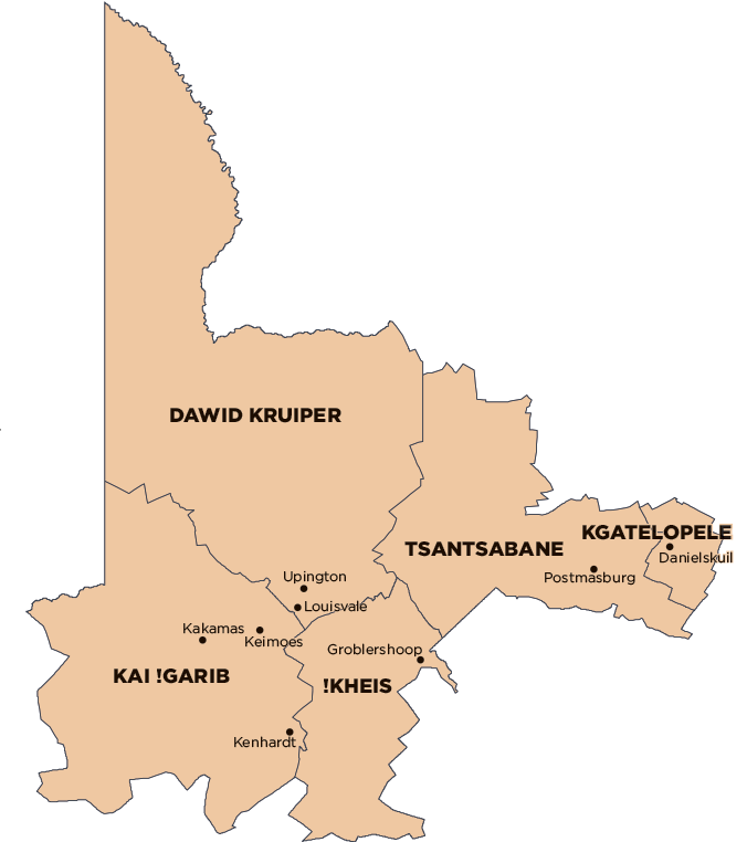
ZF Mgcawu District Municipality comprises:
!Kheis Local Municipality
Dawid Kruiper Local Municipality
Kai !Garib Local Municipality
Kgatelopele Local Municipality
Tsantsabane Local Municipality
MDB code: DC8
Description: The ZF Mgcawu District Municipality (previously Siyanda District Municipality) is a Category C municipality forming the mid-northern section of the Northern Cape Province, bordering with Botswana in the north and Namibia in the west.
It makes up just under a third of the province’s geographical area, of which 65 000km² comprise the vast Kalahari Desert, Kgalagadi Transfrontier Park and the former Bushmanland. This district comprises five local municipalities: Dawid Kruiper, Kai !Garib, Tsantsabane, !Kheis and Kgatelopele. Upington is the district municipal capital, where the municipal government is located.
Area: 102 484km²
Cities/Towns: Beeshoek, Brandboom, Danielskuil, Eksteenskuil, Groblershoop, Kakamas, Keimoes, Kenhardt, Lime Acres, Mier, Postmasburg, Rietfontein, Upington
Main Economic Sectors: Agriculture, mining, tourism