Geography, History & Economy
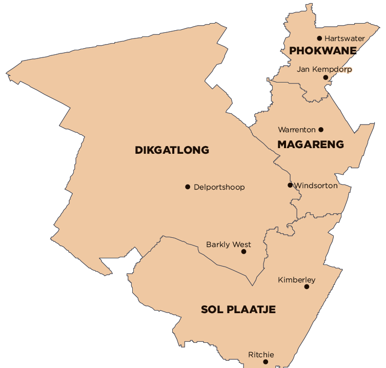
Magareng Local Municipality is part of Frances Baard District Municipality.
MDB code: NC093
Description: The Magareng Local Municipality is a Category B municipality within the Frances Baard District of the Northern Cape Province. It is bordered by Phokwane and the North West Province in the north, Sol Plaatje in the south, the Free State Province in the east, and Dikgatlong in the west.
It is one of the four municipalities that make up the district, accounting for 12% of its geographical area. Magareng is a Setswana name meaning ‘in the middle’. The name reflects the geographic location of the municipality in relation to other areas.
Area: 1 546km²
Cities/Towns: Warrenton
