Geography, History & Economy
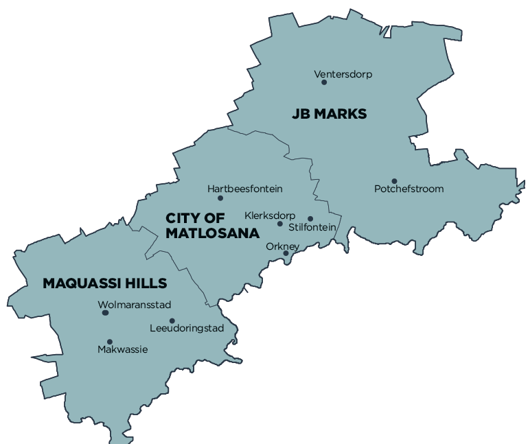
Dr Kenneth Kaunda District Municipality comprises:
City of Matlosana Local Municipality
JB Marks Local Municipality
Maquassi Hills Local Municipality
MDB code: DC40
Description: The Dr Kenneth Kaunda District Municipality is a Category C municipality in the North West Province. It is located 65km south-west of Johannesburg and borders the Gauteng Province on that side. It is the smallest district in the province, making up 14% of its geographical area. The municipality consists of three local municipalities: JB Marks, City of Matlosana and Maquassi Hills.
It is a region with a rich and diverse natural and cultural heritage, with the potential for sustained economic growth. The region is home to some of the most prominent gold mines in the world and one of the oldest meteor impact sites in the world.
The district is serviced by a number of primary roads, with the N12 Treasure Corridor forming the main development axis in the district and serving as a potential concentration point for future industrial, commercial and tourism development.
Area: 14 671km²
Cities/Towns: Hartbeesfontein, Klerksdorp, Leeudoringstad, Makwassie, Orkney, Potchefstroom, Stilfontein, Ventersdorp, Witpoort, Wolmaransstad
Main Economic Sectors: Mining (19.6%), trade (17.3%), finance (16.2%), government (13.8%), transport and communications (9.1%), manufacturing (8.8%), services (8.0%), construction (3.5%), agriculture (2.3%)